
Marquette Neighbors Block Sources
The public record for a Marquette block is a set of layers, not a single neighborhood list. The parcel map describes the land around an address. BS&A supplies the advertised address, name, and parcel routes for each selected tract. Recorded documents identify parties to land transfers. City and county records can describe land use or work at an address. Historic collections can add a date-specific view. Each source has a narrow purpose, and the difference between a recorded owner and an occupant must remain clear.
| Source | What it shows about a block | Access |
|---|---|---|
| ViewPro GIS | Subject parcel, adjoining shapes, road frontage, intersections, and map layers | Interactive map after disclaimer |
| BS&A parcel search | Advertised address, name, and PIN routes with tax context | Reference-only public search |
| Register of Deeds | Recorded owners, instruments, transfer dates, and legal descriptions | Online deeds from 1980, earlier route at the counter |
| Building permits | Address or PIN-based alteration and construction trail if released | County Building Codes and BS&A |
| City zoning and engineering | District, corridor, land-use, right-of-way, or infrastructure context | City pages and focused FOIA request |
| Historic collections | Older street references, maps, photographs, and household evidence | PWPL and history-center research access |
| MVIC voter search | Current individual registration status through a name-based form | Required name, birth month, birth year, and ZIP |
Begin with the subject parcel and add only the adjacent lots that share a boundary or face the same block. A block can contain different ownership arrangements, mailing addresses, and building histories. That is why each PIN needs its own result rather than a conclusion drawn from the first property found.
Map a Marquette Neighbor Block
The parcel-first method keeps the search centered on geography. In the ViewPro map, locate the subject address and record its parcel ID number, also called a PIN. Zoom out only far enough to identify the parcels that touch its boundary or front the same segment. Save road names and intersections as context. The next stage is not a name search of the entire neighborhood. It is a separate record check for each parcel selected from the map.
- Open the Marquette ViewPro GIS viewer, accept the disclaimer, and search by street address, owner name, PIN, intersection, or coordinates as appropriate.
- Record the subject PIN, parcel outline, adjacent lots, road frontage, nearby intersections, and the map's standardized street label.
- Run every selected PIN independently through the county BS&A search. Preserve the distinction between a situs address and a tax-roll mailing address.
- Use the current owner or legal description in the Register of Deeds record route to check recorded transfers on that particular parcel.
- Use permits, zoning, historic maps, or a directory only for the time period and fact those sources support. Do not infer residency from adjoining land.
The flow is address to GIS parcel, GIS parcel to PIN, PIN to BS&A, then owner or legal description to recorded documents. It is a block method, not a people list. For the longer record chain along a named road, use the Marquette street directory route, which follows one street parcel by parcel.
Marquette GIS Parcel Context
ViewPro is valuable because it puts the parcel in its physical setting. The documented search modes are Parcel Search, Intersection Search, and Coordinate Search. Parcel Search accepts Parcel ID No. or PIN, Owner Name, and Street Address, then uses a green Search control to open results. The viewer may require payment for some details, and the complete Marquette layer list was not captured. Use only what the live map actually displays.
GIS geometry can show which parcels are nearby, where a street joins an intersection, and how a lot relates to roads or boundaries. It cannot show a private household or an unrecorded move. Marquette neighbors should therefore be discussed as a record relationship to a parcel, not as an identity conclusion from a map.
Insider tip. If a Marquette address does not find cleanly, use the nearest intersection or the PIN, then carry the standardized street label into the BS&A and deed searches.
Marquette Block Permit Records
Permits can place work at a selected address without proving who lives there. The county Building Codes route documents lookup by address, name, parcel number, or building-department record or permit number. The live record card and its start year were not captured, so an application, work type, inspection, or status should only be described if it appears in the released record. City zoning and engineering files can add district and right-of-way context when an existing record is requested by address and date range.
Open the City of Marquette zoning source before using this zoning and records image.
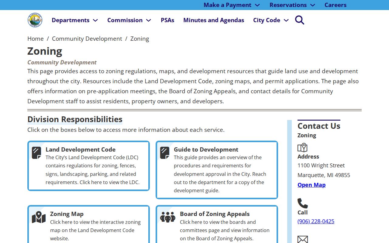
The City source is useful for understanding zoning maps, permit material, and applications around a Marquette block. It is not a roster of households, and the research did not locate a public person index for zoning or engineering files.
For the county permit entry point, open the Marquette County Building Codes lookup before using the image below.
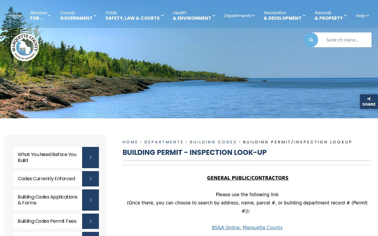
The permit route supplies an address, name, parcel, or permit-number starting point for a selected Marquette block, not a list of people at nearby addresses.
When an online route fails or a needed city record is not posted, a narrow request through Marquette's FOIA instructions should identify the address, date range, and existing record type. Michigan FOIA, MCL 15.231 et seq., covers existing non-exempt records and does not require staff to create a block summary.
Marquette Neighborhood Directory Gap
Marquette's planning material says neighborhood associations may be supported or facilitated, but research did not locate a current official citywide association or HOA directory. That gap should be stated plainly. A search result for an organization with a similar name pointed to Madison, Wisconsin, so it is not Marquette evidence. Do not turn a map label, an unverified web result, or a community meeting into a household list.
| Civic or neighborhood layer | Published status | Useful block purpose |
|---|---|---|
| City neighborhood associations | City plans support or discuss them; no current citywide directory was found | Use a boundary map only after verifying a specific local group |
| Historic Core and downtown | Named in the current master-plan material | Place and planning context, not a resident roster |
| South Marquette | Named place type in City plan material | Block geography and plan context |
| Third Street Corridor | Named corridor in City planning materials | Address orientation and development-record context |
| Downtown Development Authority | Public board and meeting layer | Public civic minutes and district context |
| Marquette Regional History Center | Historical collection, not an association | Street files, maps, photographs, and directories |
Myth: Every named Marquette district has an official neighborhood directory. The available research supports map and civic context, not a verified citywide membership list. Ask the City or history center whether a named district has a published boundary map or meeting archive.
Marquette Civic Area Records
The current City of Marquette Community Master Plan identifies place types including Historic Core and South Marquette. The Downtown Plan also gives context labels for downtown areas. Those names can help interpret a parcel's planning setting. They are not legally incorporated neighborhood boundaries and should not replace the parcel, PIN, or legal description when a record must be matched.
The City boards and committees page lists public bodies including the Downtown Development Authority, Board of Review, Planning Commission, Arts and Culture Advisory Committee, Parks and Recreation Advisory Board, Elections Board, and Peter White Public Library Board of Trustees. Agendas, minutes, applications, and appointments may identify a public civic role. They do not establish a person's household address or make a board list into a neighborhood directory.
| Official records route | Commercial neighbor-tool category | Practical difference |
|---|---|---|
| Links a specific parcel, recorded instrument, permit, or meeting to its custodian | May compile profiles from changing sources | Use the official record for the fact it actually documents |
| Shows a date, access channel, and scope limit | May mix addresses and dates without the underlying record context | Confirm a claimed match with the responsible office |
| Can be checked at the counter or through a focused request | Is not a substitute for a parcel or deed match | Do not use it to infer a current household |
Marquette Historic Block Sources
Historical block research needs a date. The Peter White Public Library local-history collection and the Marquette Regional History Center's research resources offer complementary trails. Longyear materials include street and address photographs, a residence index, city and county directories, and local maps. PWPL has directory, newspaper, map, and database paths. The Mining Journal residence index is arranged by city and street, and the newspaper run is microfilmed from 1868 through 2019, with digital access through February 1989 at PWPL.
Sanborn maps cover Marquette from 1884 through 1946. They show building footprint, use, and street context rather than people. A historic directory may place a named household at a street number, while a map can test whether the building and block match that period. Address-filed photographs can add visual context, but fragile material may have reproduction restrictions. The useful chain is historic street name or address, map or directory year, then a documented source image or citation.
Marquette Neighbor Voter Limits
Michigan Voter Information Center is not a browse-by-street system. The current name form requires first name, last name, birth month, birth year, and ZIP Code. It can be used to check an individual registration result, but not to build a block roster. A name and ZIP result should not be treated as proof that a person is physically at an address today. Registration status, parcel ownership, and actual presence are different facts.
A statewide Qualified Voter File request follows a separate form, delivery, fee, eligibility, and protected-field process. Public registration data may include a residential address, mailing address where available, year of birth, registration date, status, and history under the request conditions. Driver-license and state-ID data, month and day of birth, phone, email, digitized signature, and the last four Social Security digits are withheld. The County Clerk and City Clerk remain the local channels for election questions, not a means to recreate a public neighbor list.
Note: Historical voter registrations from 1882 to 1932 are archive material and do not substitute for a current individual MVIC check.
Limits on Marquette Neighbor Lookups
Parcel and deed sources can establish documented interests in land. They do not identify all residents of a block. A mailing address on a tax record is for correspondence, not proof of residence. A map can show adjoining boundaries, not occupants. A historic directory is dated evidence with publication conventions, not an update to the present. Careful Marquette neighbor research leaves those gaps visible rather than filling them with assumptions.
Michigan's Address Confidentiality Program is available to qualifying people at risk of physical harm and provides a designated substitute address with mail forwarding. Enrollment uses an advocate or application assistant and is not a general request to hide a name. Public information may show a designated address, an older address, or no useful location. Michigan also has no comprehensive consumer-privacy deletion and universal-opt-out law of the kind described in the Attorney General's guidance, so a request to erase a truthful public record is not a guaranteed remedy. Contact the actual custodian about a valid confidentiality or redaction basis.
Lawful use. Marquette neighbors and block records are appropriate for personal, lawful research, family history, property questions, and civic awareness. Do not use public information to stalk, harass, intimidate, or expose someone with a protected address.